Hiking Guide: Cory/Edith Pass, Banff National Park

If you love a good uphill battle, this is the right hike for you, because I am telling you right now that you will have legs of steel after you complete this one but the views are so breathtaking, it's all worth it in the end! This hike can either be done as a loop, which was what we did, or you can do Cory Pass or Edith Pass separately. It's very rewarding and is said to be one of the most breathtaking hikes in Banff National Park. This is a good day trip hike that took us 6 hours. We read on some other blogs and articles that it took people anywhere between 3-8 hours, all just depending on the pace you choose to take, how many breaks for food, photos, etc.
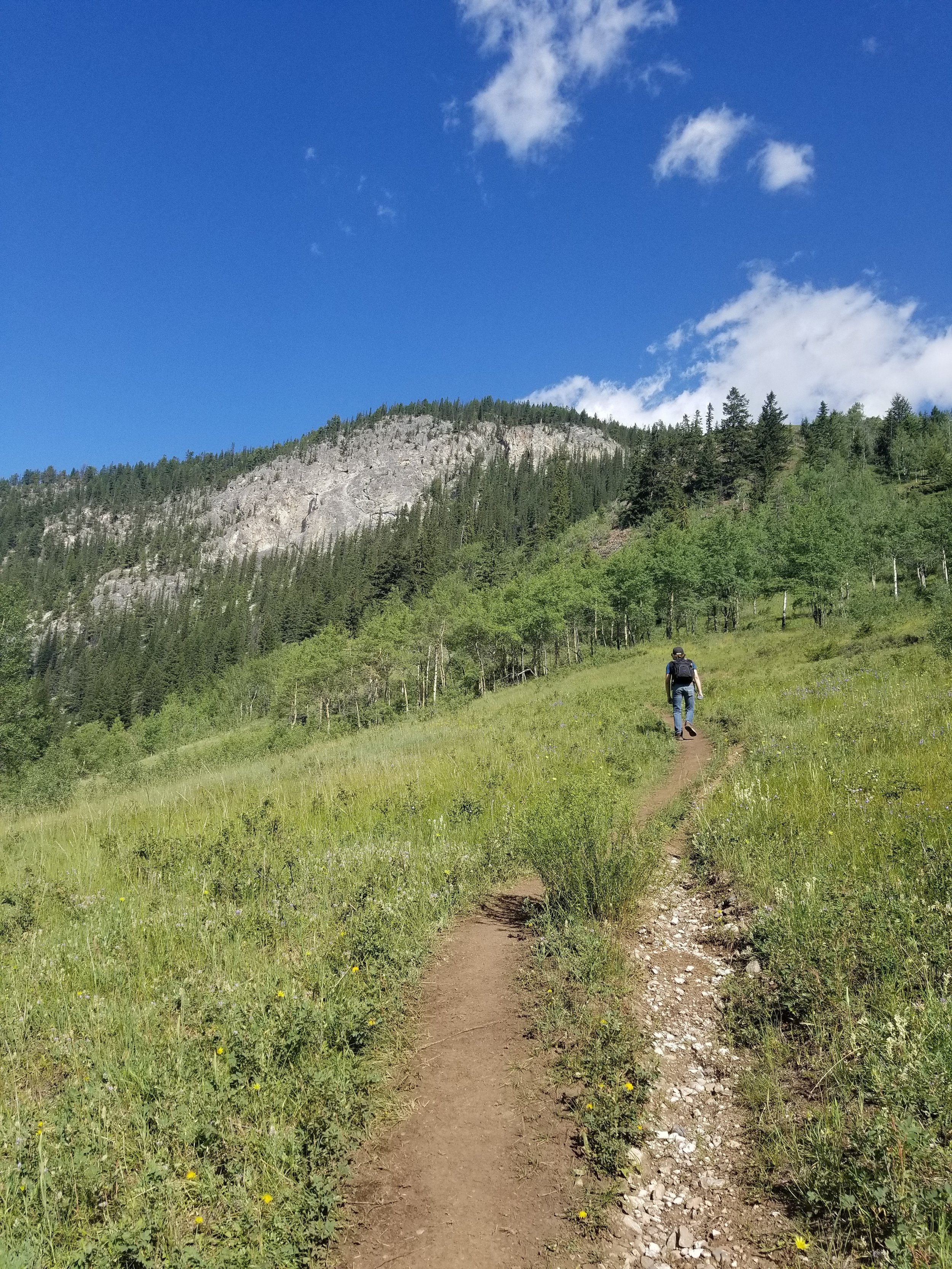
To get to the trailhead, head about 5 km west of Banff and take the Bow Valley Parkway turn-off. There is a quick right turn right after you get on the Parkway, Fireside Picnic Area access road. Follow the road about 1.0 km to the parking lot. The bridge that crosses the river is the starting point of the trail, just head to the right. If you’re hiking this on a hot day, enjoy the shaded tree area for the next kilometer because once you’re hiking up that mountain, Mother Natures rays are powerful! Be sure to load up on the mosquito spray and be sure you're equipped with your bear spray, which can be bought at MEC, Cabelas or any outdoor store.
You will get to a trail junction, where you can either go left up to Cory Pass or go right up to Edith Pass. If you are doing the circuit, I recommend going up left through Cory Pass because of how steep it is. It is better on the ascend and you wont destroy your toes trying to attempt a descend on this part of the trail! The steepness starts pretty much as the trail branches off, and it doesn’t give you much of a break until you get close to the ridge, which it levels out for a bit. Take advantage of the views of the Pass, and all around, while you’re on this ridge; they are absolutely amazing! Keep an eye peeled for any wildlife while hiking on the ridge on Mount Cory, to the left! Once the trail starts to get narrower, there are some slight looser rock sections and some more steep incline until you get to the Pass. Hiker beware - Crawling over some rocks while slightly descending are required in one part of this section. A couple that we met along the hike that ended up turning around at that part.


Views of Mount Cory off to the left. This is where you should keep your eyes peeled for wildlife!
Once you reach the pass, you have walked 5.6 km out of 13! Take in the views, but make sure you grab a sweater as the winds can get very strong up here, and the Pass is known for getting rain. With being at such a high elevation, weather can turn on you very quick. Make sure you pack for the conditions! Take your pictures and then try to find a little bit of shelter behind some trees and enjoy lunch and a well deserved break — you’re going to need to fuel up, you still have 7 km ahead of you!


The summit and side view of Mount Edith, which we did not tackle but it's on the list!
Once you are fueled up, packed up and ready to go, you can begin your descent on the back side of Cory Pass into Gargoyle Valley. It is a steep, rocky descent into Gargoyle Valley but eventually levels out, but I would consider the whole valley a scramble as there are some up’s and down’s on mainly loose shale. Be sure to just take your descent nice and slow, as it's very easy to have your feet slide out from under you right here. The best way we found to go down was just to walk sideways and lean your weight backwards. The trail through the Valley is very rugged with lots of loose rock, but still well defined and easy to find!


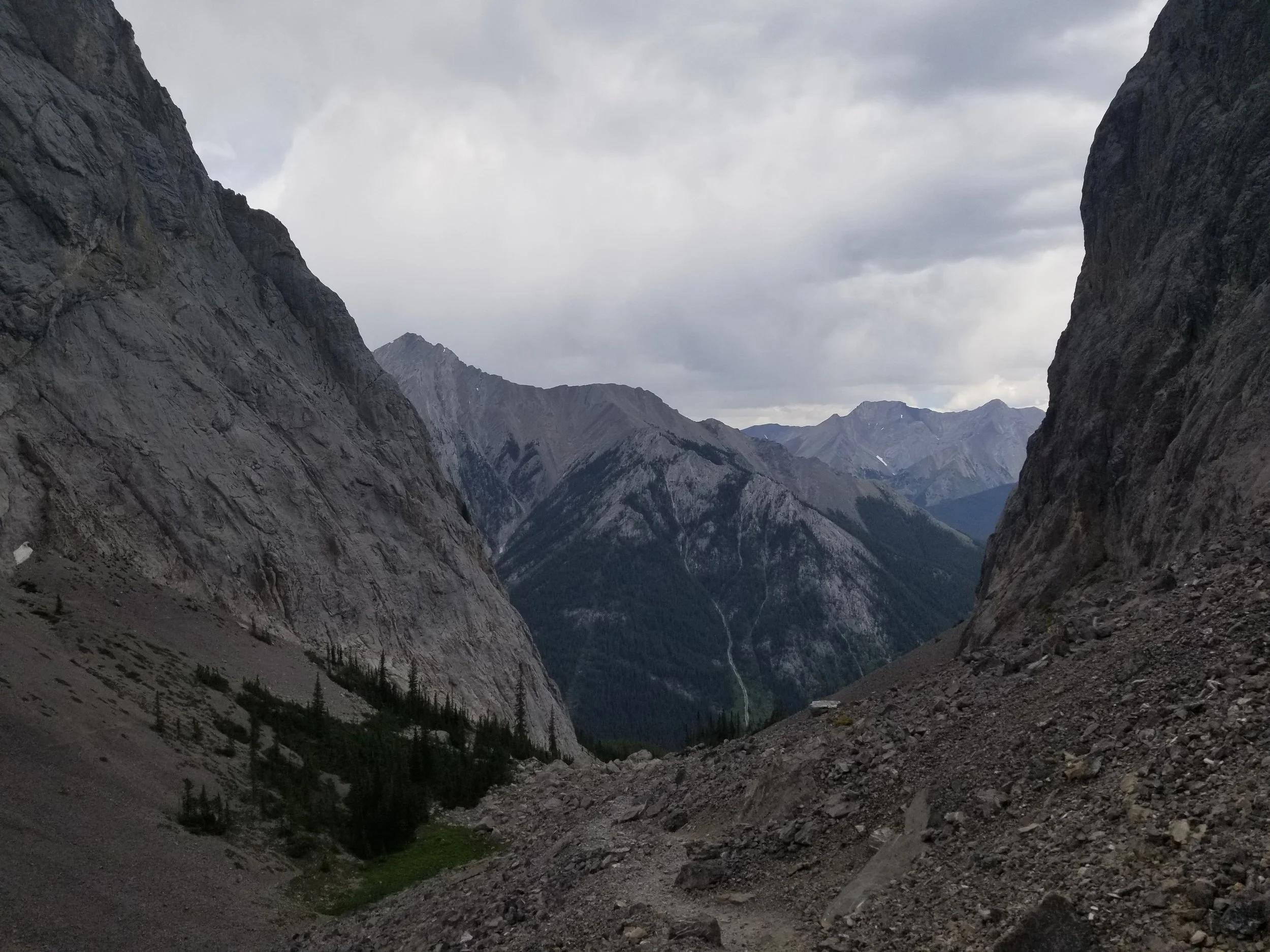
Once you get to the other end of the Valley, it opens up onto a rockslide landing. You have reached Edith Pass and this is were you will have views the Forty-Mile Creek. Some hikers do lose the trail here, so just look for the long scree slope leading to the right. My boyfriend and I just ended up crawling over the rocks to the trail. If worse comes to worse, just head right while on a slight descent, you'll eventually meet up with trail. Here you will start descending and walking through lightly forested, weeded areas and what not. You will get to a rocky section right before a tree line that you will need to ascend. You will see a trailhead sign, and that will get you back on the Edith Pass trail that will take you back to your vehicle. Take in your last bit of views right now!
